The 2024 Food Insecurity Index, created by Conduent Healthy Communities Institute, is a measure of socioeconomic and household hardship correlated with poor food access. The index is part of Conduent's SocioNeeds Index® Suite, which provides analytics around social determinants of health to advance equitable outcomes for a range of topics.
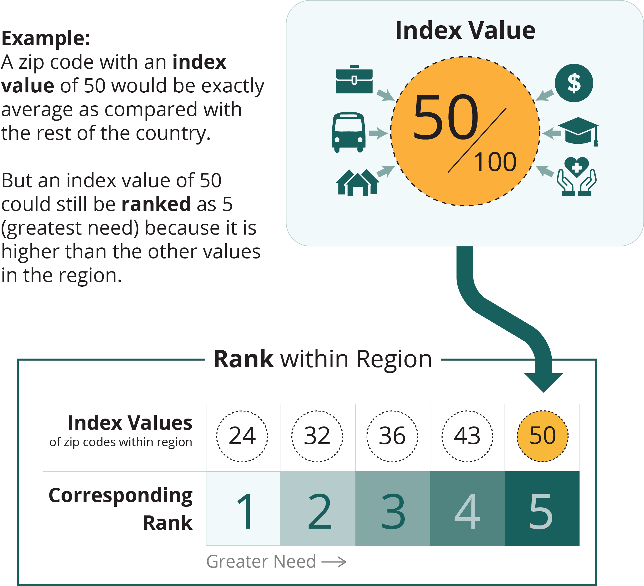
All zip codes, counties, and county equivalents in the United States are given an index value from 0 (low need) to 100 (high need). To help you find the areas of highest need in your community, the selected locations are ranked from 1 (low need) to 5 (high need) based on their index value relative to similar locations within the region.

map legend
greater need


| Zip Codesort column | Indexsort column | Ranksort column | Countysort column |
|---|---|---|---|
| 63366 | 36.8 | 5 | St. Charles |
| 63301 | 34.9 | 5 | St. Charles |
| 63385 | 31.4 | 4 | St. Charles |
| 63376 | 27.8 | 4 | St. Charles |
| 63304 | 21.8 | 3 | St. Charles |
| 63368 | 18.2 | 3 | St. Charles |
| 63303 | 17.4 | 3 | St. Charles |
| 63367 | 10.2 | 2 | St. Charles |
| 63348 | 10.0 | 2 | St. Charles |
| 63373 | 8.9 | 2 | St. Charles |
| 63341 | 2.4 | 1 | St. Charles |
| 63386 | 2.0 | 1 | St. Charles |
| 63332 | 1.6 | 1 | St. Charles |
Data Source
The Food Insecurity Index is calculated by Conduent Healthy Communities Institute using data from Claritas Pop-Facts®, 2024; Claritas Consumer Spending Dynamix, 2024; and American Community Survey 2018-2022.
Technical Note
Index values are not comparable across measurement periods. Index values and rankings are specific to a measurement period, showing the relative ranking of a location in comparison to other similar locations at that time.